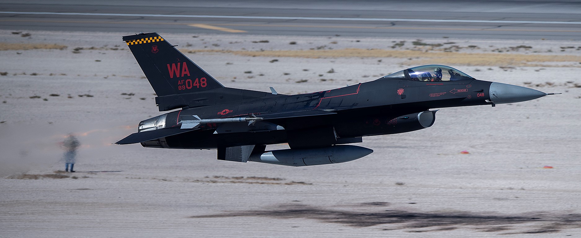
U.S. Air Force photo by Senior Airman Miranda A. Loera, 28OCT2019.
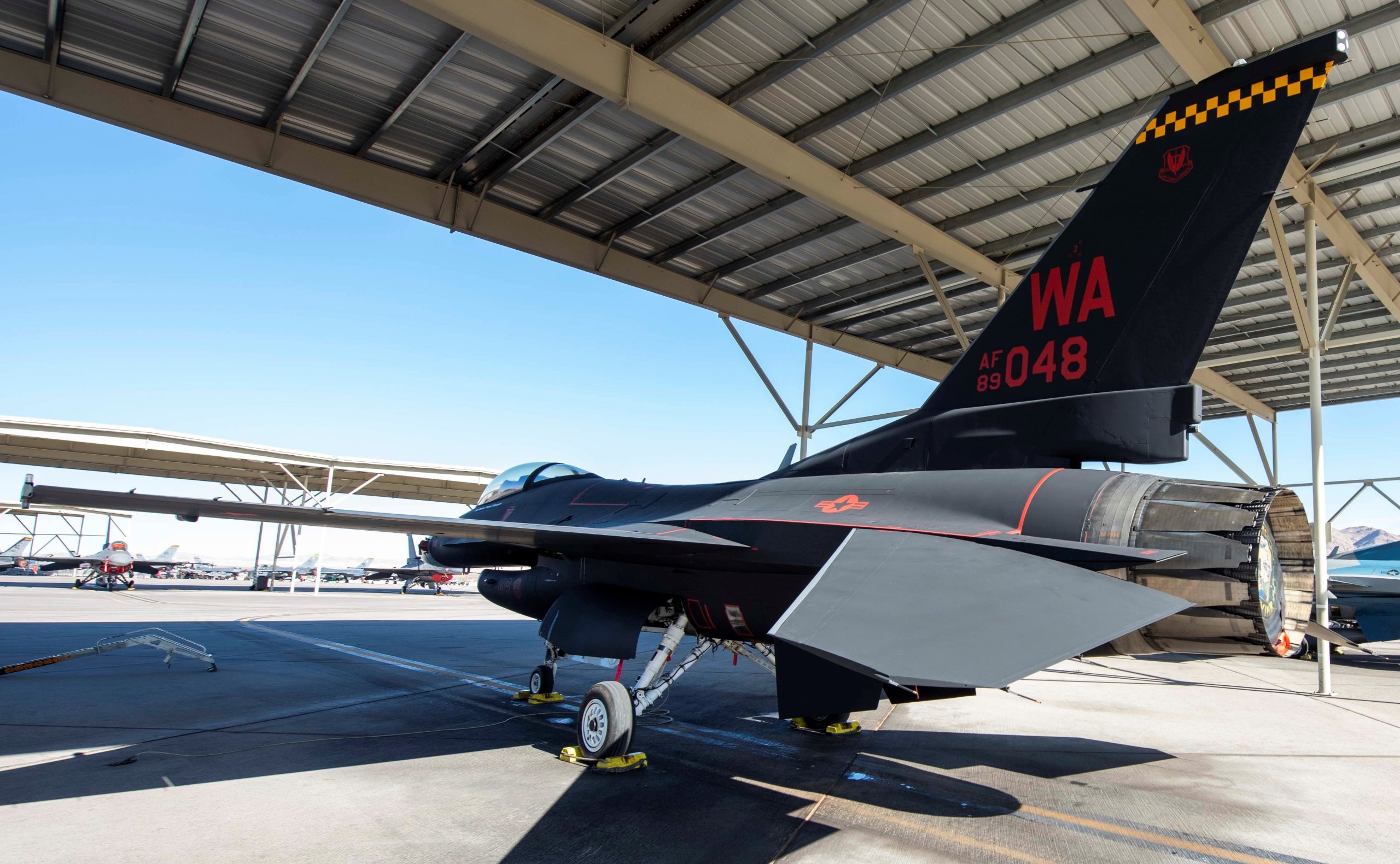
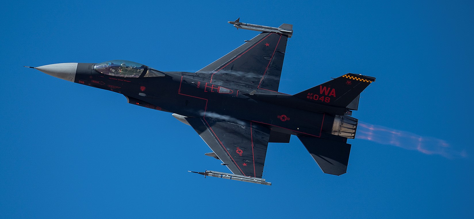
On 28OCT2019 the 64th Aggressor Squadron (Nellis Air Force Base, Nevada) revealed their new ‘Wraith’ paint-job for the F-16.
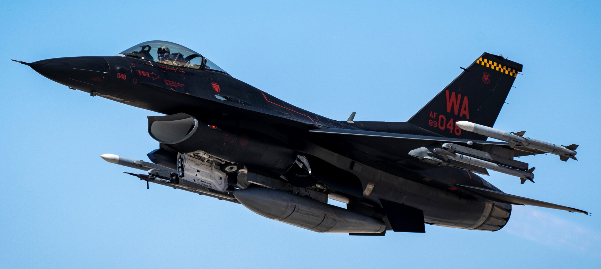
USAF photo by Airman First Class Bryan Guthrie, 16NOV2019.
The paint scheme resembles the late World War Two/Korean conflict U.S. night fighter paint-job; black with red markings. However, in WW-2/Korea the black was glossy as U.S. Army Air Force studies revealed that amazingly glossy black actually was harder to see from the ground with search lights, than a flat/matte (‘nonspecular’ as it was called back then) black. The new F-16 Wraith uses flat black.
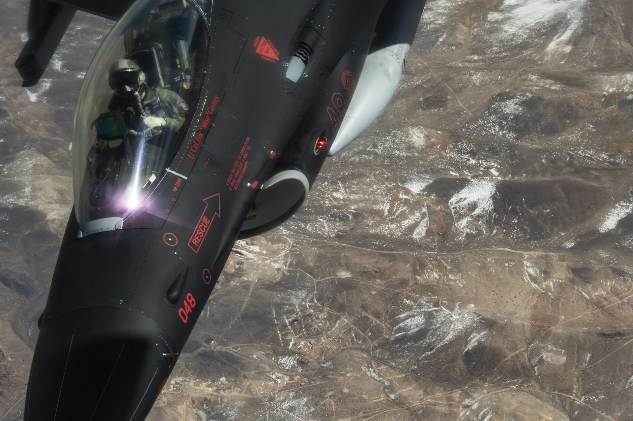
USAF photo by Airman First Class Bryan Guthrie, 16NOV2019.
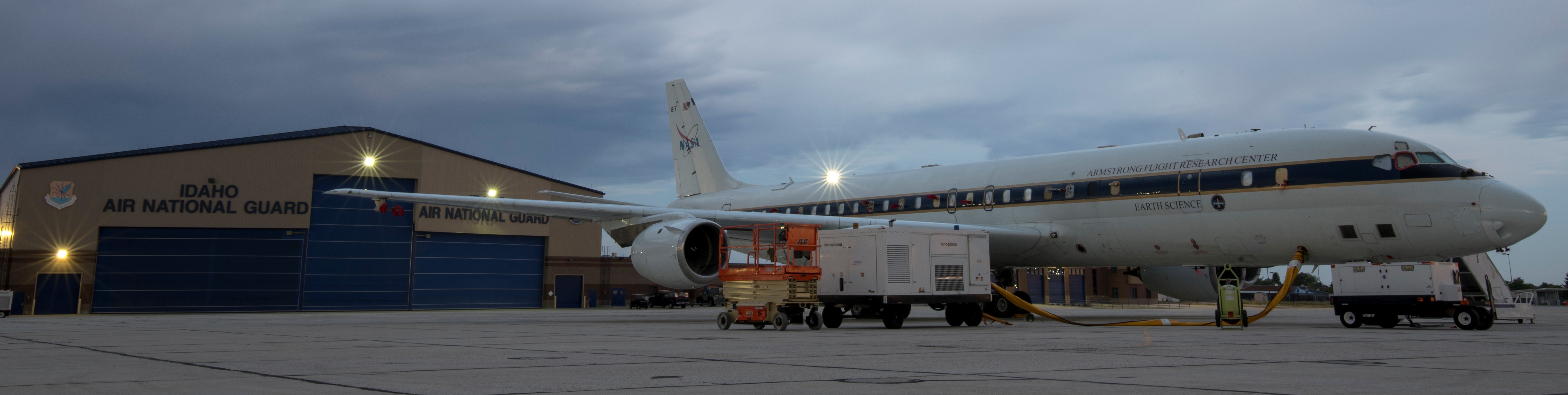
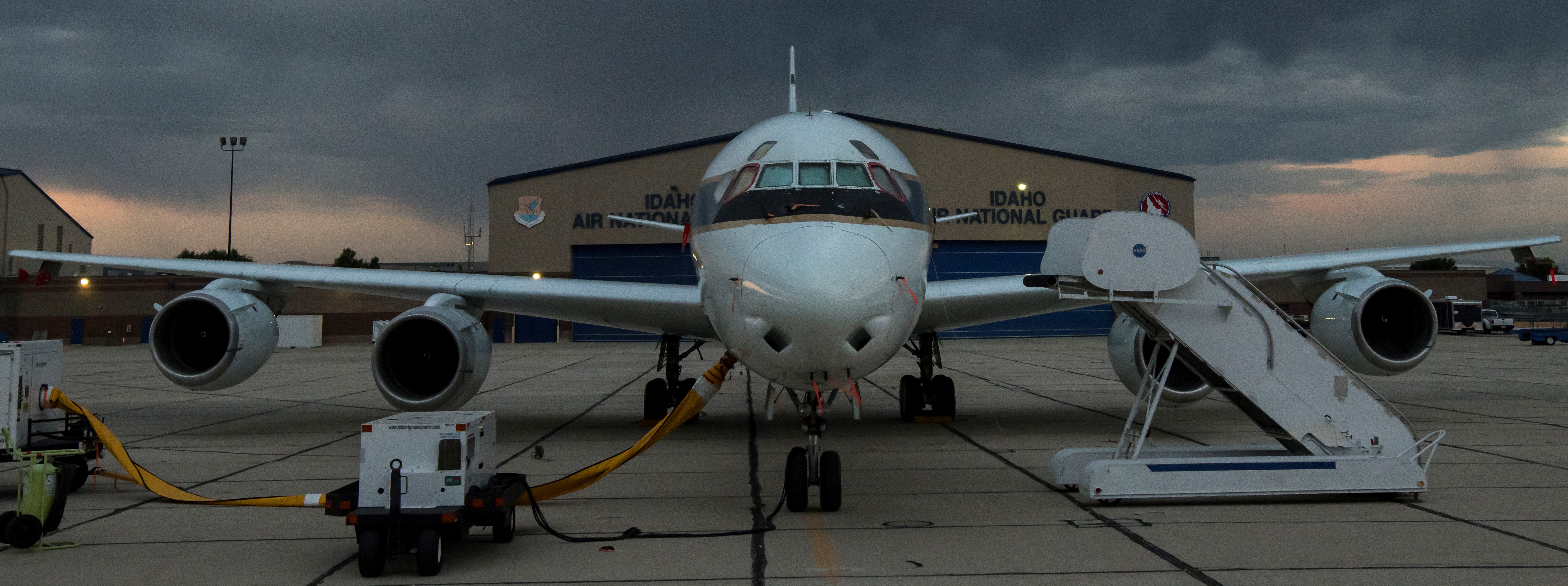
NASA-Armstrong DC-8 Airborne Science Laboratory sits on the east ramp of the 124th Fighter Wing, Boise, Idaho, 23JUL2019. Idaho Air National Guard photo by Master Sergeant Joshua C. Allmaras.
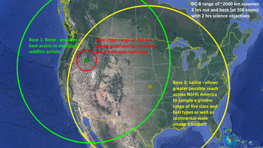
NASA’s aged and heavily modified DC-8 airliner is conducting air monitoring missions in relation to the growing wildfire danger in the western U.S.
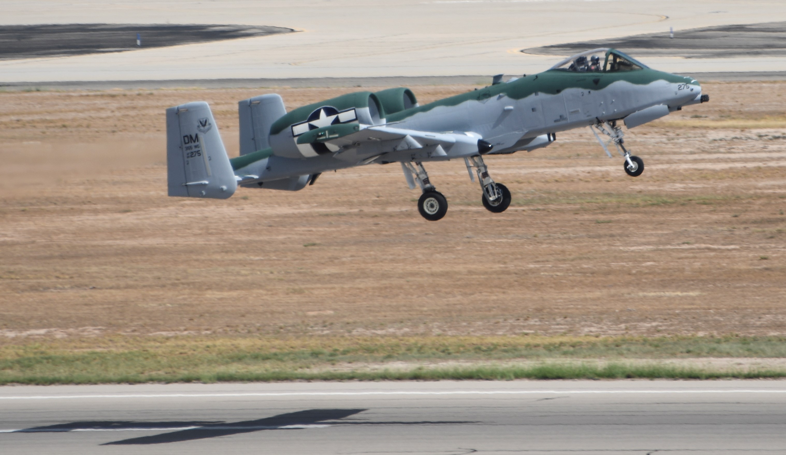
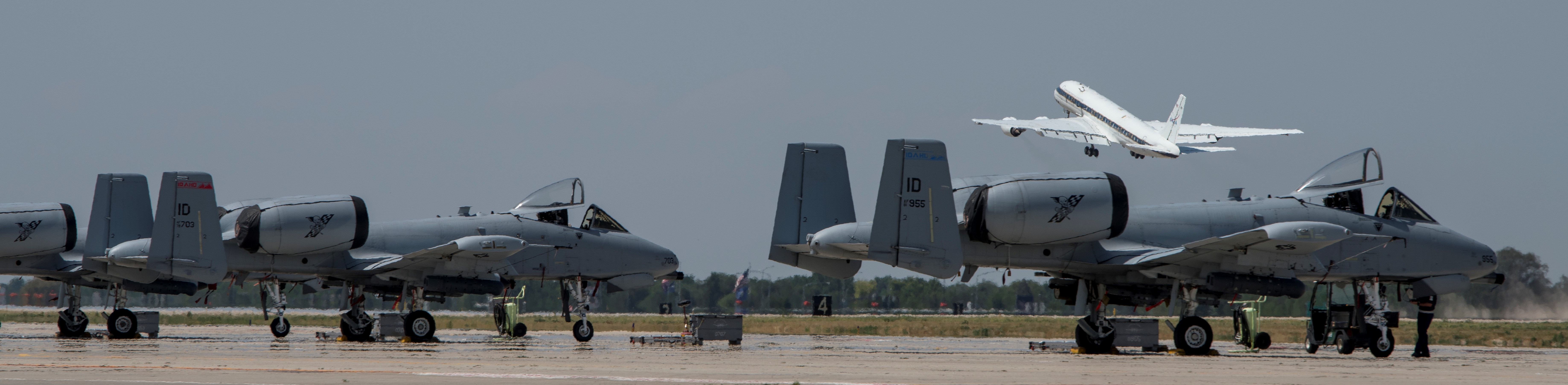
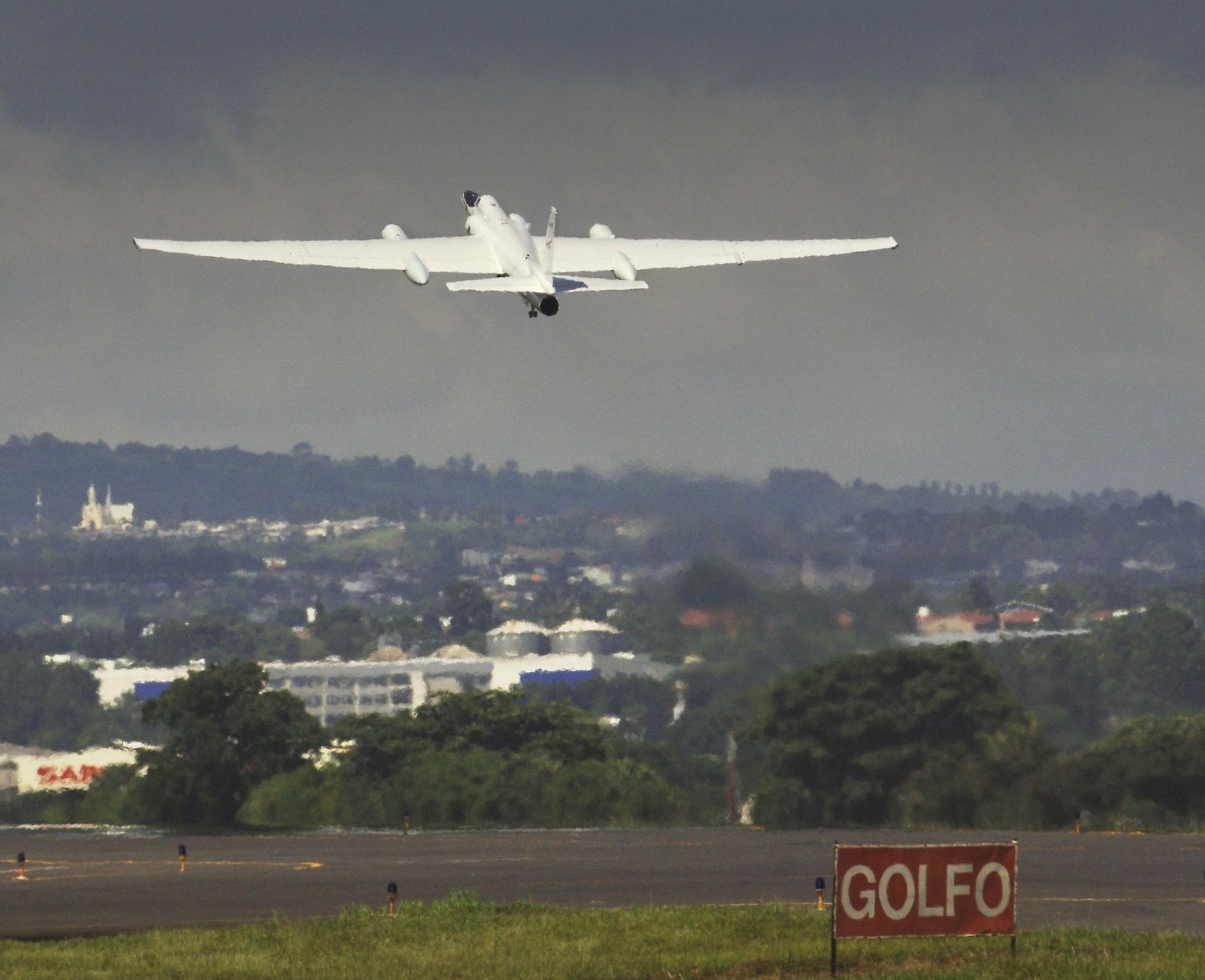
Idaho National Guard A-10Cs in the foreground, NASA’s DC-8 FIREX-AQ takes off from Gowen Field (Boise Airport), 30JUL2019.
President Donald Trump is portrayed by the ‘main-stream’ news media as being anti-climate, yet since he became President of the United States NASA (National Aeronautics Space Administration) has seemingly increased its studies of the effects of pollution and wildfires (including prescribed burns and agricultural fires) on the atmosphere.
On 23JUL2019, NASA held an explainer day for Idaho news media, and as you can tell not many showed up. Idaho Air National Guard photo by Master Sergeant Joshua C. Allmaras.
Looking like chaff/flare dispensers these are actually Airborne-Synthetic Aperture Radar (AirSAR) antenna. NASA photo 26MAR1998.
NASA says their DC-8 flys at 42-thousand feet (12-thousand-801 meters or 12.80 kilometers) for as long as 12 hours, collecting air samples with the many antennae protruding from the fuselage.
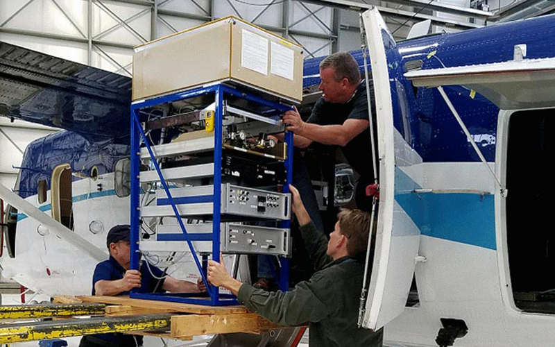
FIREX-AQ sensors. Idaho Air National Guard photo by Master Sergeant Joshua C. Allmaras, 23JUL2019.
More sensors, Idaho Air National Guard photo by Master Sergeant Joshua C. Allmaras, 23JUL2019.
In 2016, the NASA DC-8 was in Korea conducting high-altitude monitoring of air quality, from Osan Air Base. U.S. Air Force photo by Technical Sergeant Travis Edwards, 27APR2016.
Video explainer of NASA’s DC-8 mission over Korea:
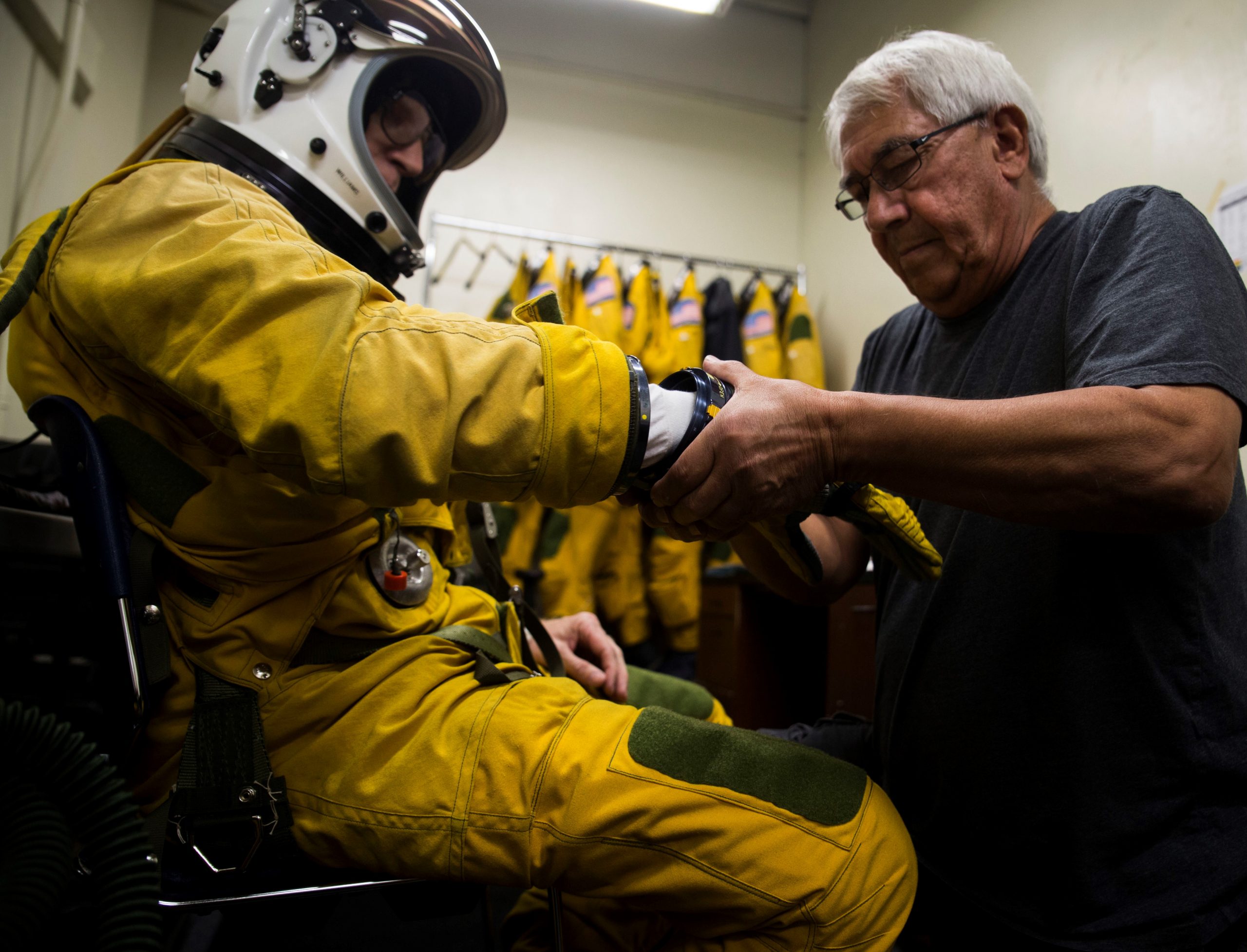
NASA pilot suits-up for an ER-2 AVIRIS-NG mission high over Hawaii, February 2018. U.S. Marine Corps photo by Lance Corporal Luke Kuennen.
Six decades after California set the first global standards for industrial anti-air-pollution laws the National Aeronautics Space Administration (NASA) has proven those (and subsequent) laws to be laughable.
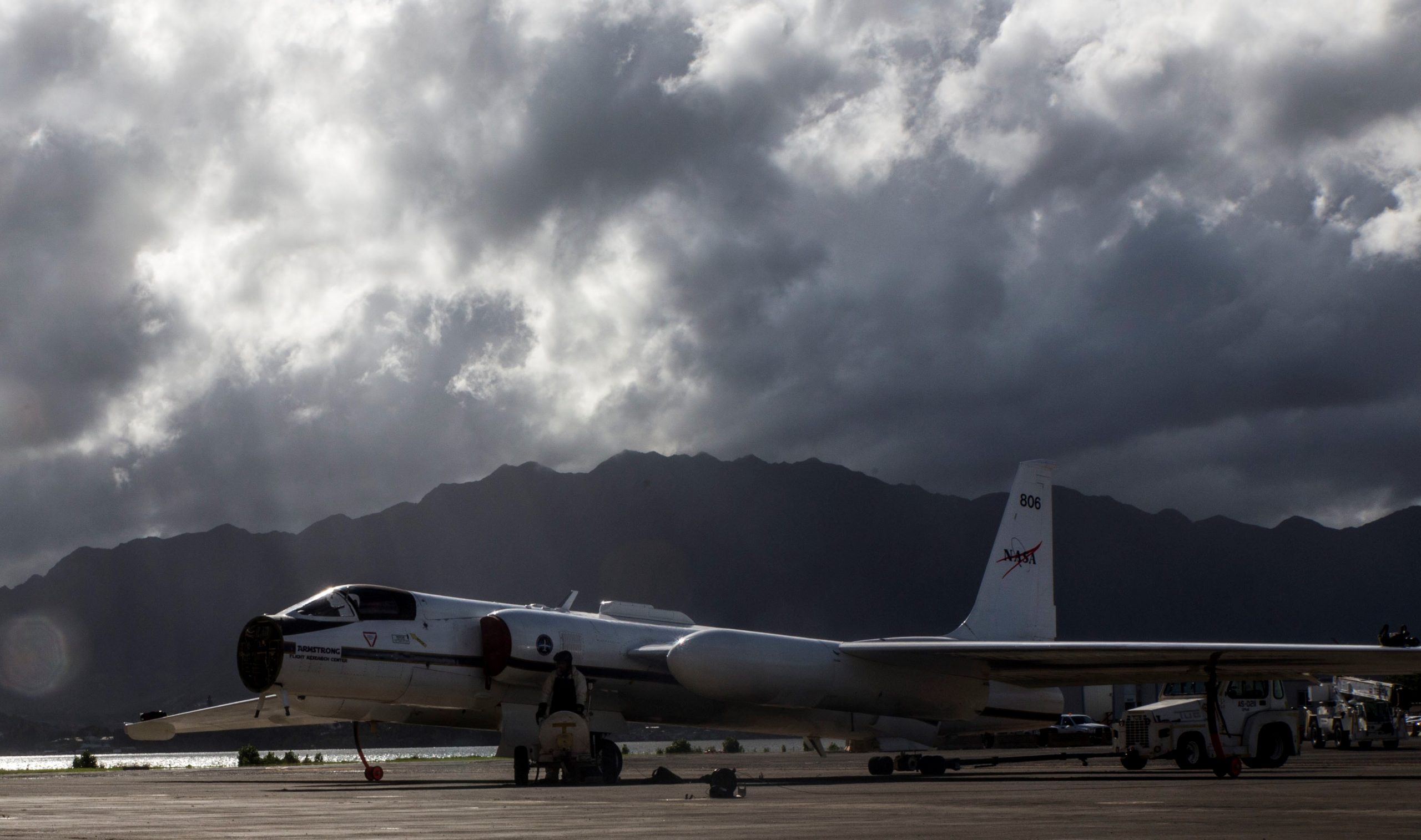
NASA ER-2 preps for a mission from Marine Corps Air Station Kaneohe Bay, Hawaii, February 2018. USMC photo by Lance Corporal Luke Kuennen.
NASA used it’s modified U-2R/TR-1A, called the ER-2 (Earth Resources-2), to inspect industrial air pollution, scanning the ground from near-space (65-thousand feet/19-thousand-812 meters): “Before the pilots even take off, we put them on 100% oxygen for an hour to get all of the nitrogen out of their systems. It’s similar to what scuba divers can face. If they have nitrogen in their system, they can end up getting what they call the bends, and it’ll be a really bad day for that pilot.”-Wason Miles, ER-2 life support crew, from 2018 interview concerning the HyspIRI preparatory airborne mission over Hawaii
Liquid nitrogen is used to cool the ER-2’s hyperspectral thermal emission spectrometer. USMC photo by Lance Corporal Luke Kuennen.
The two years long NASA-California methane mission resulted in the AVIRIS-NG ( Airborne Visible InfraRed Imaging Spectrometer-Next Generation) system, onboard the ER-2, discovering dozens of what NASA calls methane “super-emitters”(published 06NOV2019) across the Los Angeles area. This why I say California’s progressively ‘tougher’ anti-pollution laws failed. I lived in California when those anti-pollution laws began driving out many industries causing the loss of thousands of jobs just in the Los Angeles area, in the 1970s-80s. The exalted lawmakers of The Golden State then started playing games with their own anti-pollution laws, trying to woo back major employers. NASA’s California methane mission revealed that the industrial sector of the Los Angeles area is still pumping out clouds of pollution, even with stricter air quality laws and fewer industrial operations.
NASA photo by Jim Ross, 13JUL2006.
Boring 2018 lecture type NASA explainer video about how AVIRIS detects and maps methane emissions:
NASA photo by Lori Losey, August 2001.
2017 NASA video explainer of their climate-spy-plane AVIRIS system:
ER-2 tail#706, over Edwards AFB, California, 04NOV1997. NASA photo by Carla Thomas.
In the 1990s, NASA had three ER-2s, but now has two. The other ER-2 was returned to the U.S. Air Force.
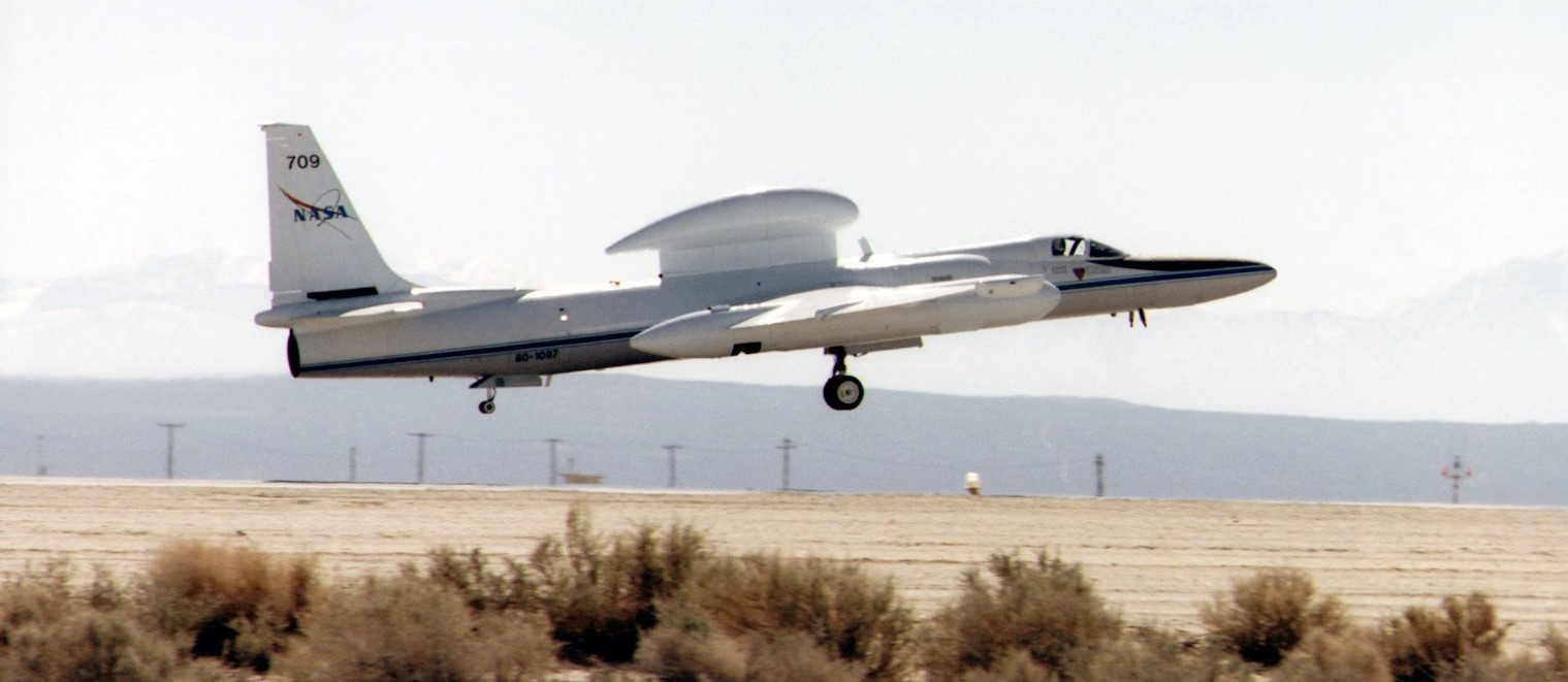
ER-2 tail#709. NASA photo by Tony Landis, 18FEB1998.
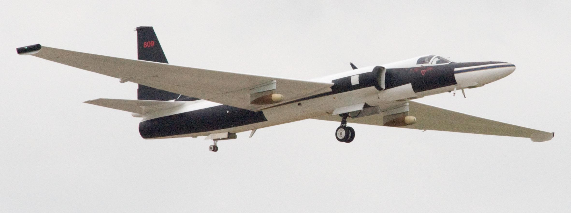
Lockheed ER-2 tail#809 cockpit. NASA photo by Tony Landis, 11DEC1999.
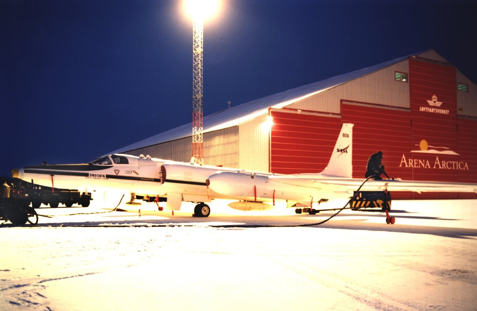
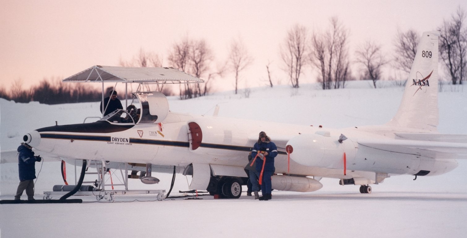
ER-2 #809 receives fuel outside Arena Artica hangar in Kiruna, Sweden. SAGE-3 Ozone Loss & Validation Experiment (SOLVE), January 2000. NASA photo by Jim Ross.
ER-2 #809 in Kiruna, Sweden for SAGE-3 Ozone Loss & Validation Experiment (SOLVE), January 2000. NASA photo by Jim Ross.
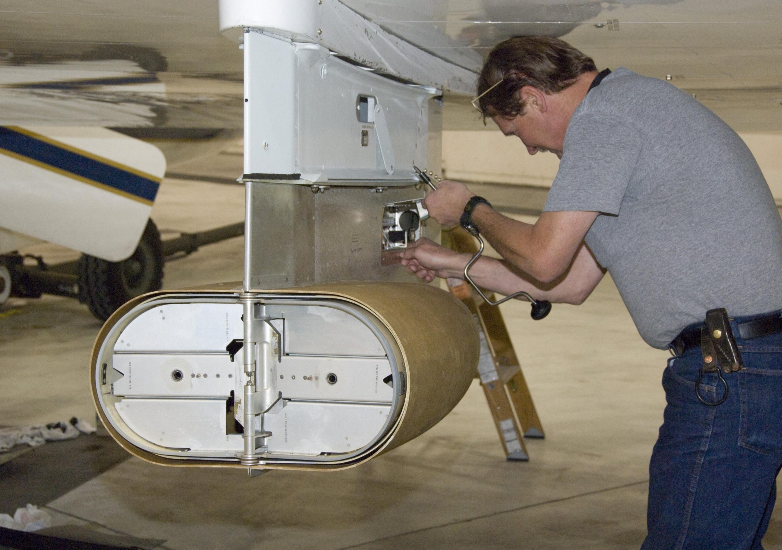
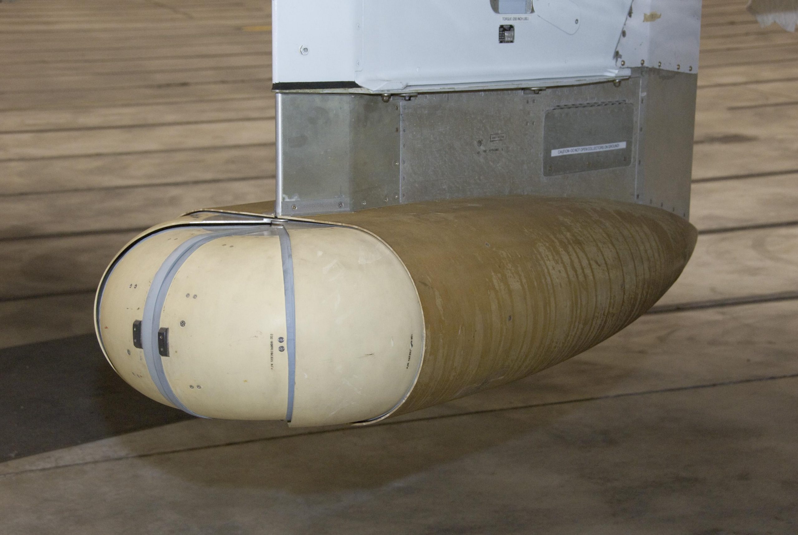
The ER-2, which has been in use for decades, can be equipped with a variety of sensors.
Large Area Collector sensor for a cosmic dust collection. NASA photo by Tom Tschida, 24APR2009.
ER-2 under-wing mounted cosmic dust collector pod. NASA photo by Tom Tschida, 24APR2009.
ER-2 Tropical Cloud Systems and Processes (TCSP) mission over Costa Rica, 06JUL2005. NASA photo by Bill Ingalls.
May 2010 pic of NASA’s ER-2 overflying the British Petroleum’s Deepwater Horizon Gulf of Mexico oil spill. NASA photo by Regan Geeseman.
Incomplete (tip-o-the iceberg) list of main-stream-news links about global immigrant/border operations affecting the United States taxpayers, October 2019.
Somewhere in the eastern Pacific, 11OCT2019, U.S. Coast Guard personnel pose on top of the drug smuggling submarine they captured. During an eight week period the Coast Guard captured 11 smugglers and an estimated U.S.$216-million worth of illegal drugs.
Security cam video of vehicle illegally crossing from Canada into U.S. (near Lynden), seven illegals from British-empire’s United Kingdom were captured by Border Patrol, 02OCT2019:
27 October 2019 (13:09 UTC-07 Tango 06) 05 Aban 1398/27 Safar 1441/29 Jia-Xu 4717
Real short thermal image video of 27OCT2019 X-37B landing:
“The sky is no longer the limit for the Air Force and, if Congress approves, the U.S. Space Force.”-General David L. Goldfein, U.S. Air Force
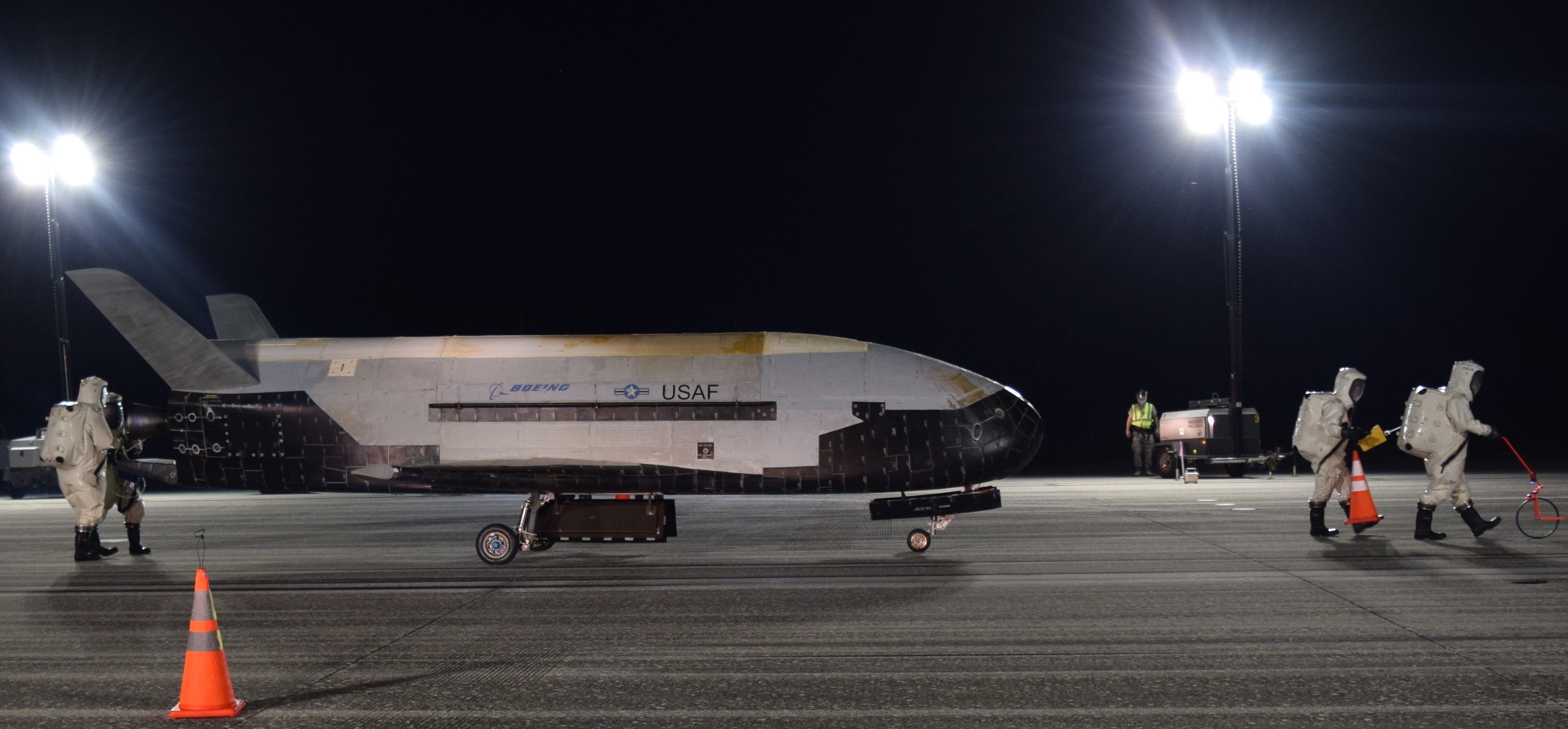
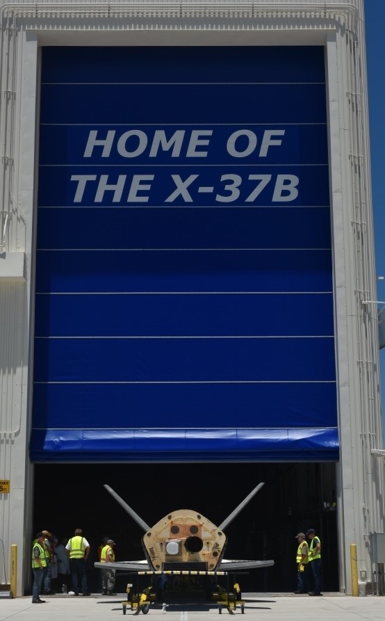
After two years in orbit, the space drone X-37B returned to Earth, setting a record: “The X-37B continues to demonstrate the importance of a reusable spaceplane. Each successive mission advances our nation’s space capabilities.”-Barbara Barrett, Secretary of the Air Force
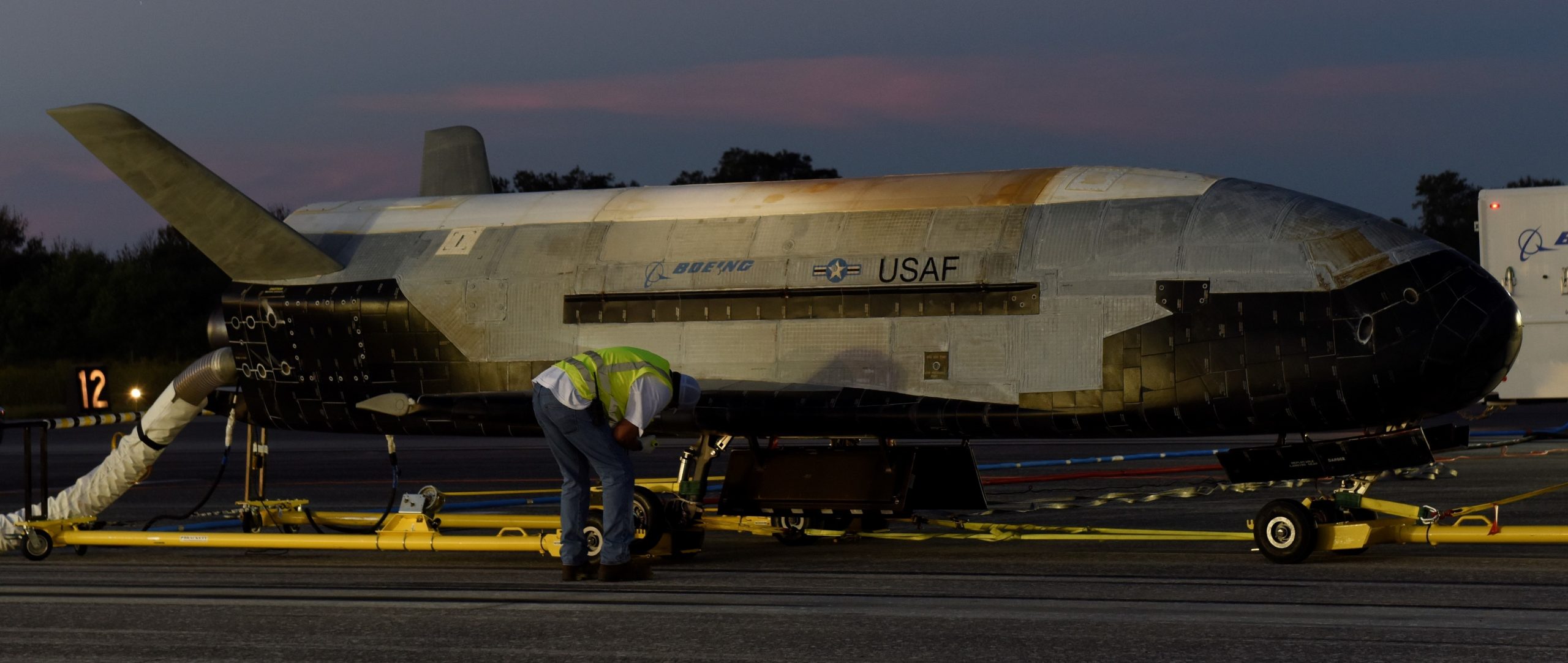
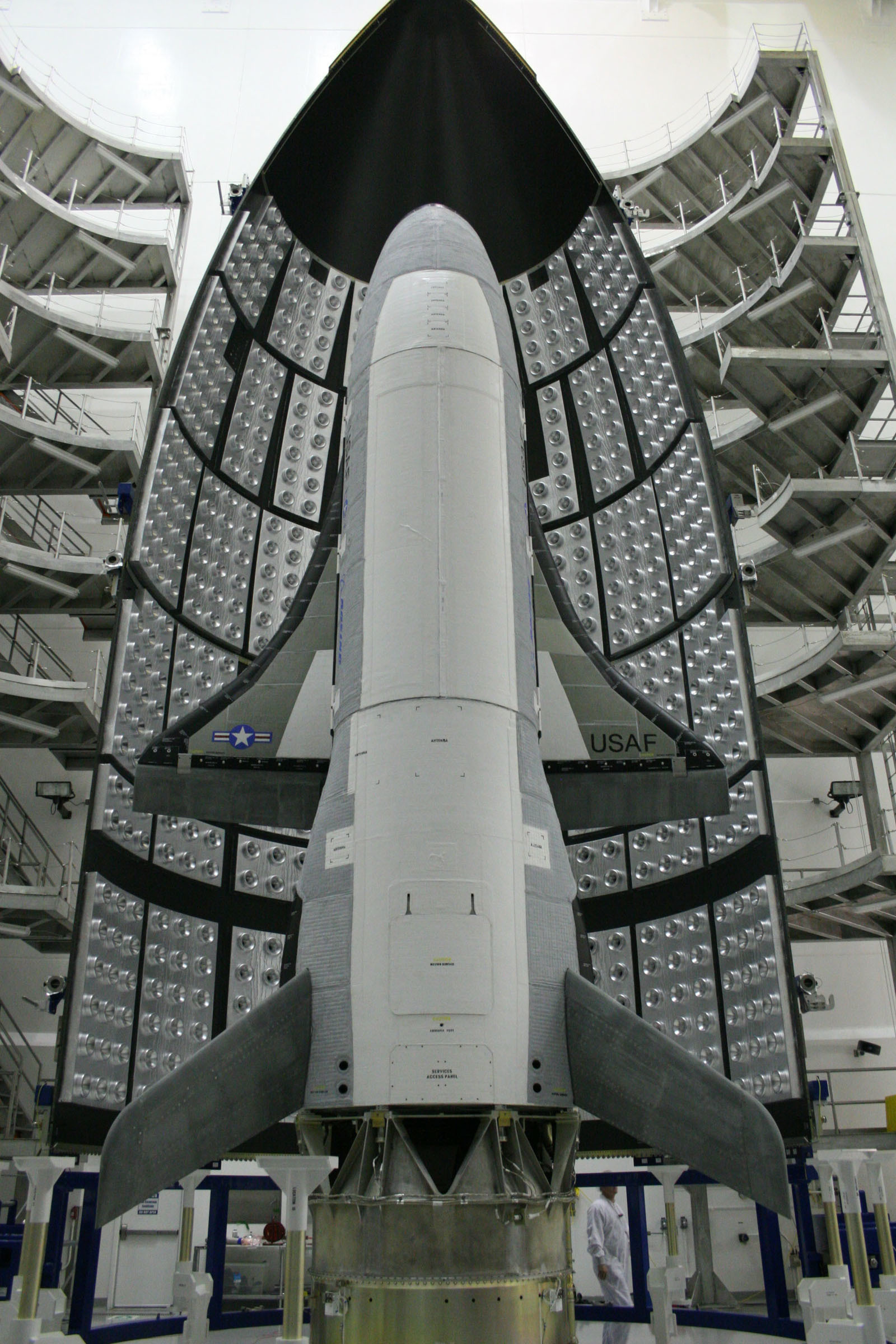
Photo via Space Launch Delta 45.
At 03:15 Eastern U.S. Time, 27OCT2019, the Orbital Test Vehicle (OTV) landed at NASA’s Kennedy Space Center in Florida, completing 780 days in orbit during its fifth test mission: “This program continues to push the envelope as the world’s only reusable space vehicle. With a successful landing today, the X-37B completed its longest flight to date and successfully completed all mission objectives. This mission successfully hosted Air Force Research Laboratory experiments, among others, as well as providing a ride for small satellites.”-Randy Walden, Air Force Rapid Capabilities Office
You should keep in mind how significant the 780 days in orbit are, as the Boeing X-37B was originally designed for only 270 day-orbits.
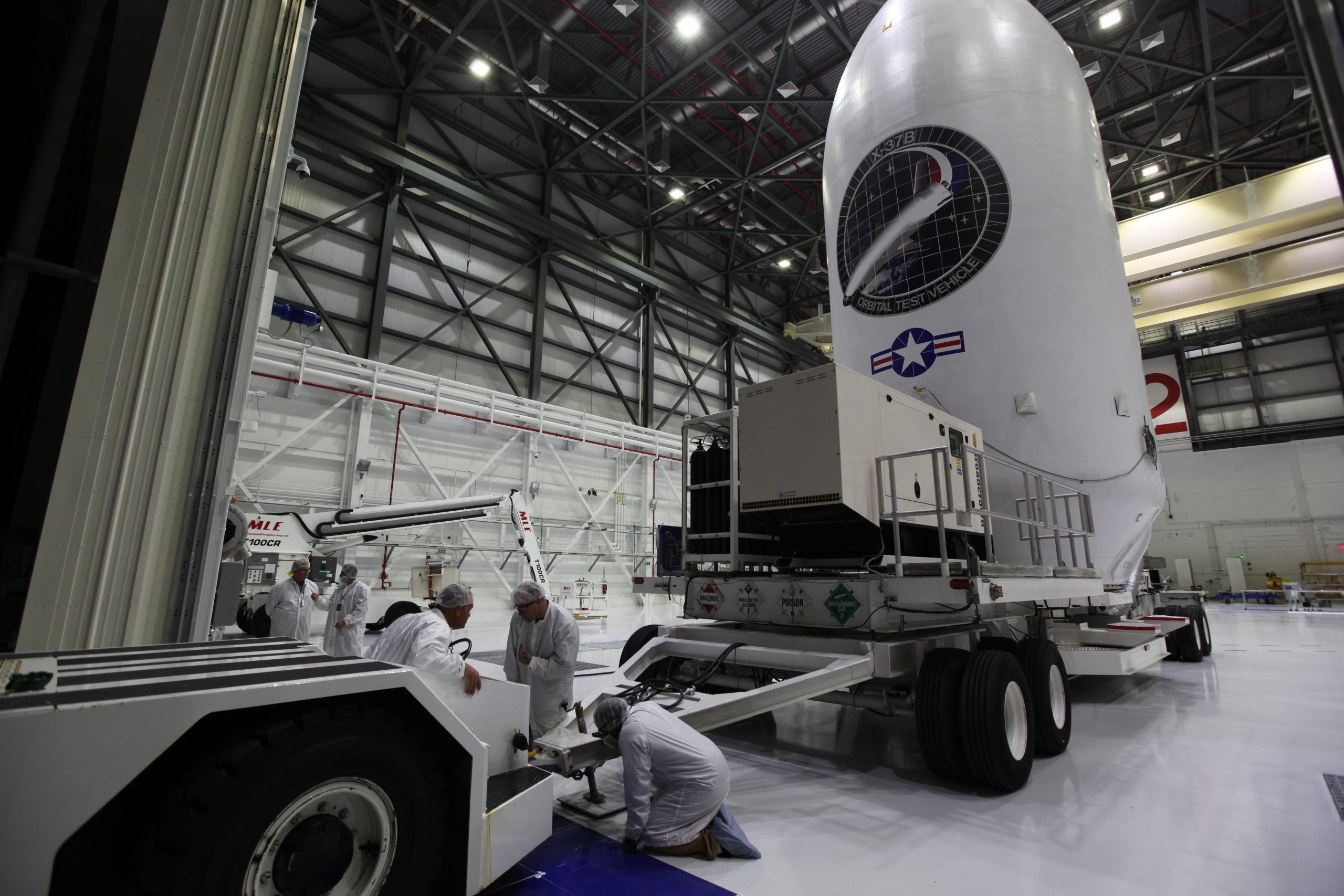
The X-37B OTV is placed inside a pod for launching, 31AUG2017. Photo via Boeing.
X-37B Mission-5 launched on 07SEP2017 from Cape Canaveral Air Force Station, Florida, on-board a Space X Falcon 9 booster (Air Force Awards Launch Services Contracts to SpaceX). Mission-6 will launch sometime in 2020.
Launch pod carrying X-37B is towed to the Space-X rocket, which can be seen waiting in the background, 05SEP2017. Photo via Boeing.
2017 official video explainer of the X-37B:
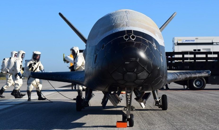
U.S. Air Force photo, 07MAY2017.
Video of X-37B Mission-4 landing, 07MAY2017, Kennedy Space Center. Watch as it roles past a Space Shuttle ‘gate guard’:
USAF photo, 07MAY2017.
What’s it like to have the X-37B fly over your head? Watch the video:
Before the use of a SpaceX rocket, the X-37B was launched by the old Atlas-5. Video, March 2015, Atlas-5 rocket launches AFSPC-5 satellite carrying X-37B from Cape Canaveral:
Video, 2012 Pentagon Report reveals unmanned space plane was taken over by DARPA from NASA:
The X-37B OTV being placed inside the launch capsule/pod, 31MAR2010. USAF photo.
Incomplete (tip-o-the iceberg) list of main-stream-news links about global immigrant/border operations affecting the United States taxpayers, September 2019.
The state militia publicly remembered the 103rd anniversary of its deployment to the Mexican border in September 1916, in response to Mexican rebel raids into the U.S.
In Northern Territory, the Australian military, along with U.S. Marines, trained for operation Crocodile Response, a bilateral humanitarian assistance and disaster relief exercise in order to more rapidly respond to natural disasters and crises throughout the region.
South Korea Ministry of Environment’ K-water operations, and U.S. Army Corps of Engineers, work with NASA to develop satellite technology in the hopes of preventing future water disasters.
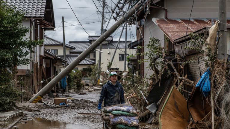
U.S. personnel from Osan Air Base respond to the aftermath of Typhoon Lingling, 07SEP2019.
UNITED STATES: FEMA (Federal Emergency Management Agency) hints that its running out of money by telling people to save money to help pay for disaster expenses!
USMC video promoting 30SEP2019 deployment to Colombia, bragging about spending U.S. taxes to help the South American country prep for a major natural disaster:
Yet again, U.S. taxes going to send U.S. Marines to Central American countries for yet more natural disaster preps (in October):
Idaho; Idaho State University, working with Idaho National Laboratory and Center for Advanced Energy Studies, gets $1.1-million taxpayer funded grant to build first ever Disaster Response Complex. The goal is to train emergency responders in a realistic catastrophic environment with multiple scenarios such as earthquakes, hurricanes, flooding, and even terrorist threats.
Health professionals representing 20 countries gathered for the 22nd annual Health Emergencies in Large Populations (H.E.L.P.) course in Honolulu, from September 9th-20th. It was hosted by Center for Excellence in Disaster Management and Humanitarian Assistance (CFE-DM) in collaboration with the International Committee of the Red Cross (ICRC) and the University of Hawai’i Office of Public Health Studies. The main goal is to create a common language, and procedures, between civilian and military emergency responders around the world.
Even though Mongolia is not a Pacific Rim country, the U.S. decided to conduct humanitarian assistance and disaster relief ‘Pacific Resilience’ training in the Central Asian country, and ordered Oregon’s Army National Guard to participate.
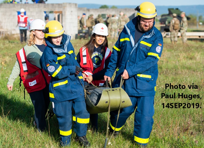
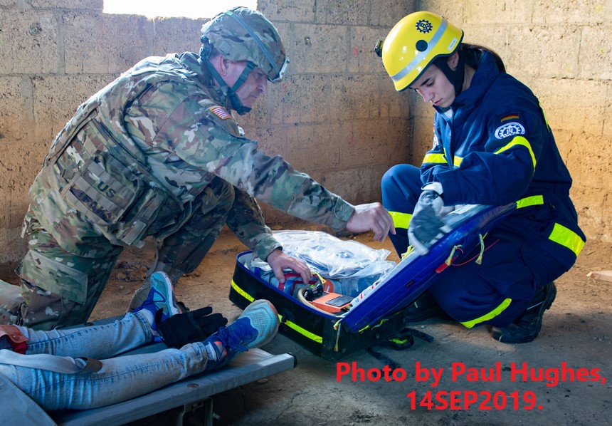
“The normal infrastructure was completely down and therefore our team came in to do our quick assessment. The Bundeswehr came out and they’re getting assessed on what they do on their medical side.”-Specialist Christopher Wise, U.S. Army Europe
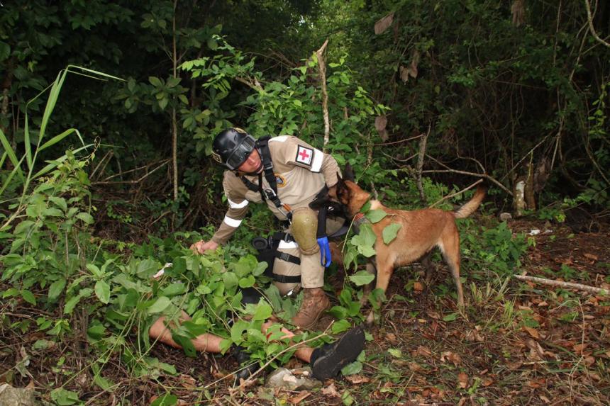
On 14SEP2019 Wackernheim, Germany, was rocked by a 6.2 earthquake. U.S. and German Soldiers rescued casualties from the debris, evacuated them to a medical treatment area and rendered first aid.
Just kidding! It was part of NATO war game Cobra Strike 19. Here’s the boring official video explainer:
Here’s a slightly better video explainer:
Earthquakes are rare in Germany, but every now and then they have a big one. Seismicity in Germany


 The two years long NASA-California methane mission resulted in the AVIRIS-NG ( Airborne Visible InfraRed Imaging Spectrometer-Next Generation) system, onboard the ER-2, discovering dozens of what


 Somewhere in the eastern Pacific, 11OCT2019, U.S. Coast Guard personnel pose on top of the drug smuggling submarine they captured. During an eight week period the Coast Guard captured 11 smugglers and an estimated U.S.$216-million worth of illegal drugs.
 U.S. Coast Guard captured 95 illegals being trafficked aboard a ship from Dominican Republic, 06OCT2019.
 Typhoon Hagibis:


 The first wall panel goes up at the Yuma 5 Mile Project, 05SEP2019.
 CBP personnel ‘process’ survivors of Hurricane Dorian, evacuating from Bahamas, 07SEP2019.
 The state militia publicly remembered the 103rd anniversary of its deployment to the Mexican border in September 1916, in response to Mexican rebel raids into the U.S.
 In Northern Territory, the Australian military, along with U.S. Marines, trained for operation Crocodile Response, a bilateral humanitarian assistance and disaster relief exercise in order to more rapidly respond to natural disasters and crises throughout the region.
 The Japanese military held Remote Island Disaster Exercise training at Yaeyama Islands, 01SEP2019.
 South Korea Ministry of Environment’ K-water operations, and U.S. Army Corps of Engineers, work with NASA to develop satellite technology in the hopes of preventing future water disasters.
 U.S. personnel from Osan Air Base respond to the aftermath of Typhoon Lingling, 07SEP2019.
 FEMA (Federal Emergency Management Agency) hints that its running out of money by telling people to save money to help pay for disaster expenses!
 Health professionals representing 20 countries gathered for the 22nd annual Health Emergencies in Large Populations (H.E.L.P.) course in Honolulu, from September 9th-20th. It was hosted by Center for Excellence in Disaster Management and Humanitarian Assistance (CFE-DM) in collaboration with the International Committee of the Red Cross (ICRC) and the University of Hawai’i Office of Public Health Studies. The main goal is to create a common language, and procedures, between civilian and military emergency responders around the world.
 Even though Mongolia is not a Pacific Rim country, the U.S. decided to conduct humanitarian assistance and disaster relief ‘Pacific Resilience’ training in the Central Asian country, and ordered Oregon’s Army National Guard to participate.